

How to spend a summer weekend in Stowe
My 3 favorite hikes

Stowe has no shortage of outdoor activities, but after years spent in these mountains, these are the trails I keep going back to. Whether you’re looking for a short and beautiful trip to a pond or longer day, these three hikes capture what Stowe has to offer.
Sterling Pond
Difficulty: Moderate
Length: 2.3 miles out and back
Gain: ~938ft
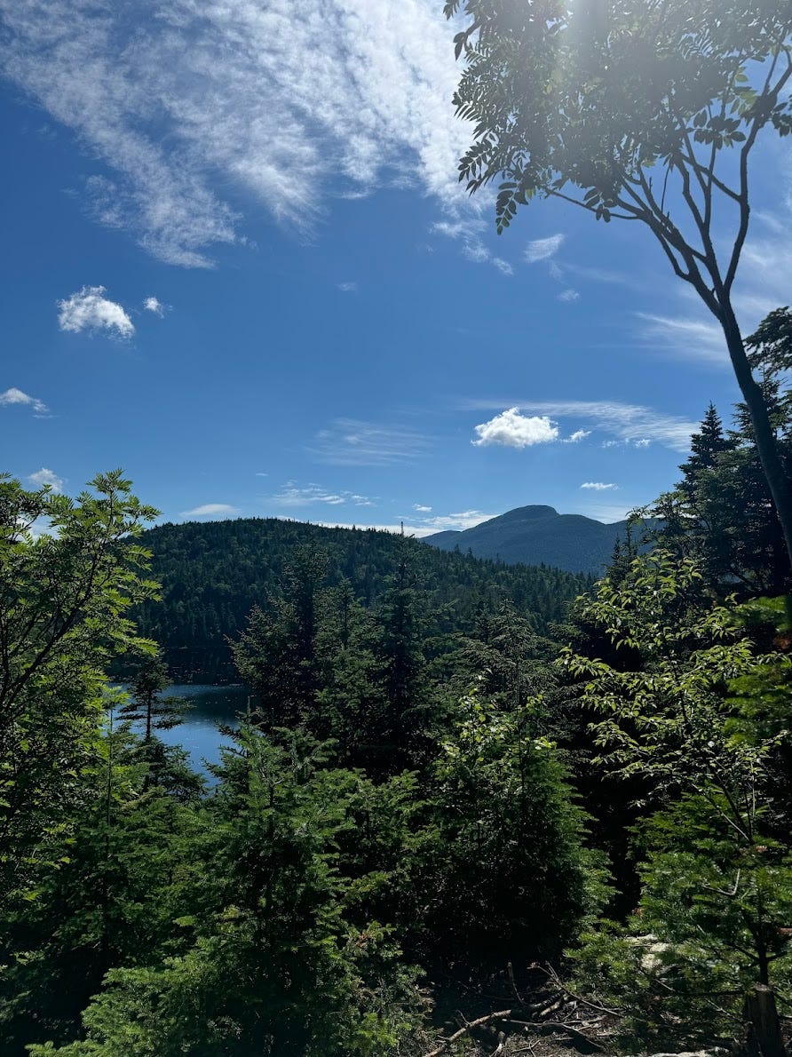
Seemingly short and sweet on paper, don’t let this hike fool you. The Sterling Pond Trail earns its reputation with a steep, calf-burning climb right out of the gate. It begins with a long stretch of stone steps off Route 108 at the top of Smugglers’ Notch, following a stream bed most of the way. The forest stays thick up until it meets the Long Trail, just under a mile in. Turn left and within a quarter mile it opens up to Sterling Pond, reflecting Madonna Peak just across.


Whenever I have friends visiting, this is one of the first spots I bring them to. I always pack some snacks and sit on the rock before heading back down. If it’s a warm day, bring a towel and take a dip in the pond to cool off.
Find the trail here.
The Nose via Haselton Trail
Difficulty: Difficult
Length: 4.5 miles out and back
Gain: 2,850ft
Starting from the base of Stowe Mountain Resort behind the Midway Lodge, the Haselton Trail is a true forest hike. The lower section winds through dense woodland, that’s been thinned just enough to let sunlight in. The trail steepens as it climbs, eventually breaking onto open ski runs before topping out at Auto Toll Road.


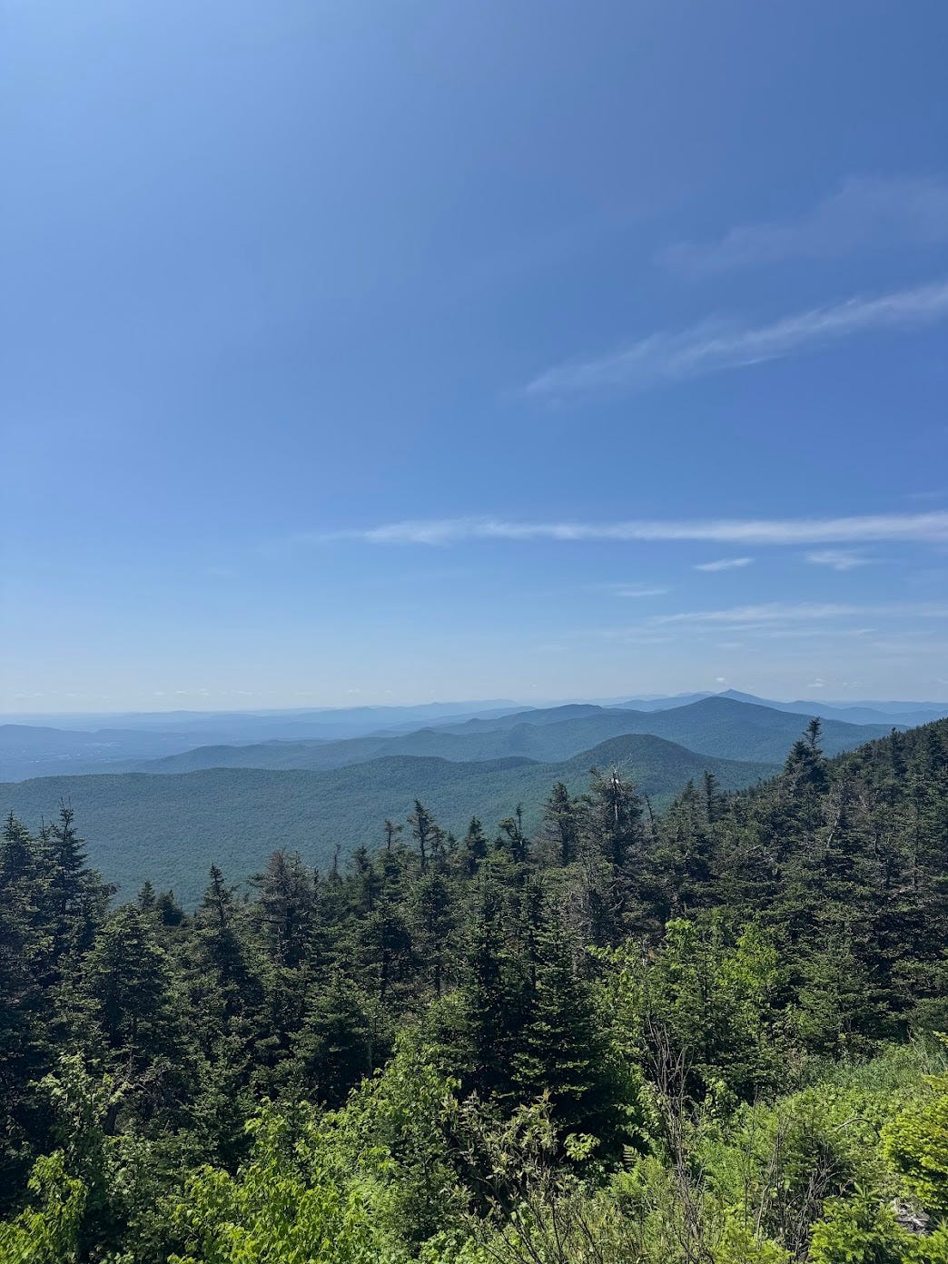
From there, continue up the road to the Long Trail and follow the ridge to the Nose, Mount Mansfield’s iconic secondary summit at 4,062 feet. The views from the top are some of my favorite — Stowe spreads out below, Lake Champlain stretches to the west, and on a clear day you can spot Mount Washington in New Hampshire and Mount Marcy in New York. Bring a beer and get a sandwich at Edelweiss to enjoy before heading back to the car. One important note: the Haselton Trail is designed for ascent. The steep, rocky upper sections are not recommended for the descent — plan to either retrace the Auto Road or connect to another route on the way down.
Find more details here.
The Chin via Long and Profanity Trail
Difficulty: Difficult
Length: 5.5 miles loop
Gain: 2,300ft
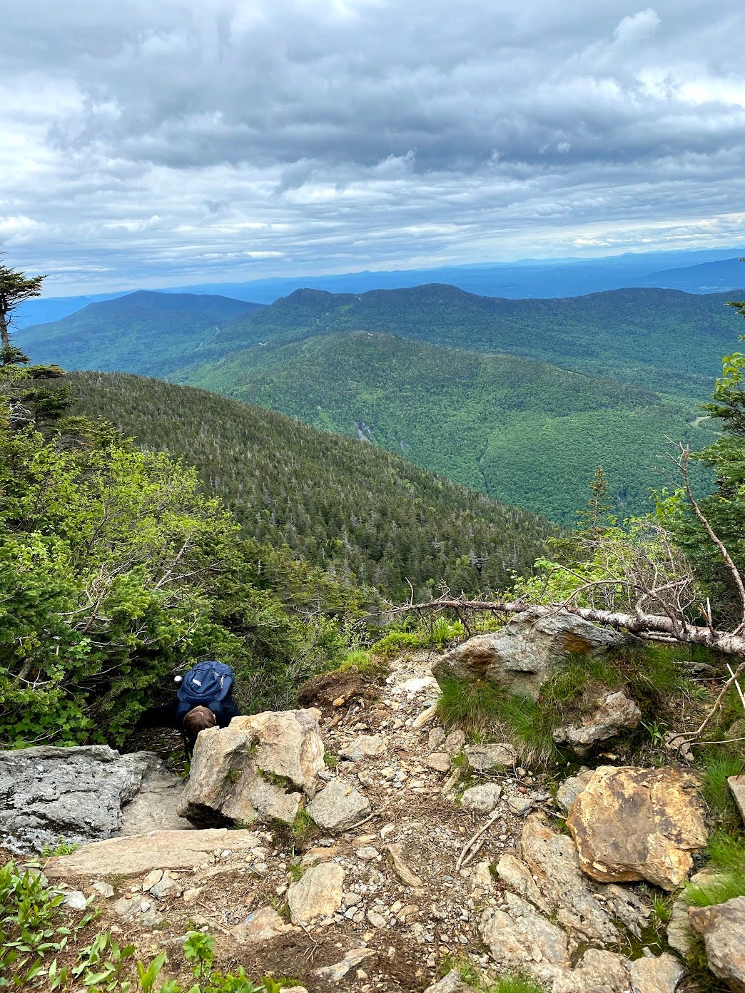
This is the big one but definitely gives a taste of everything. The loop starts at Stowe Mountain Resort’s Lower Barnes Lot and climbs the Long Trail immediately and without apology. The ascent is relentless — steep, rocky, and technical in sections, be prepared for some scrambling — but the trail eventually breaks onto the exposed ridgeline where the sky opens up and the effort starts to make sense. The route passes the Upper Lip before cresting at the Chin, the true summit of Mount Mansfield at 4,393 feet and the highest point in Vermont.
The descent offers a choice: continue down the Long Trail or cut onto the Profanity Trail, a 0.5-mile bypass that lives up to its name with steep, narrow scrambles but is slightly more forgiving going down—if you’re a backcountry skier, take note since these are some popular lines in the winter. Both routes converge at Taft Lodge before connecting to the Haselton Trail for the final descent back to the resort. Bring lots of water, snacks, and patience. June through October is the sweet spot, though the mountain makes its own rules.


New England doesn’t believe in switchbacks, and Stowe is no different. Any one of these three trails is a great day in the mountains — do all three and you’ll leave Sunday exhausted and with some pretty decent memories.