

At the end of the road
Your three day guide to Telluride

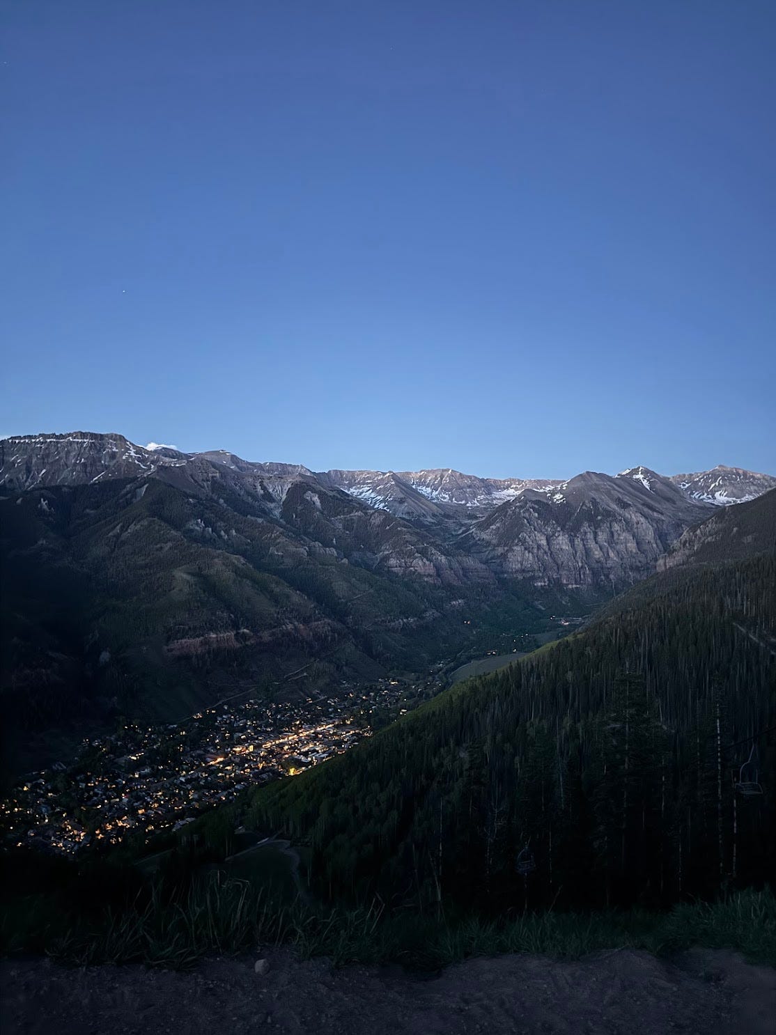
Travel Day
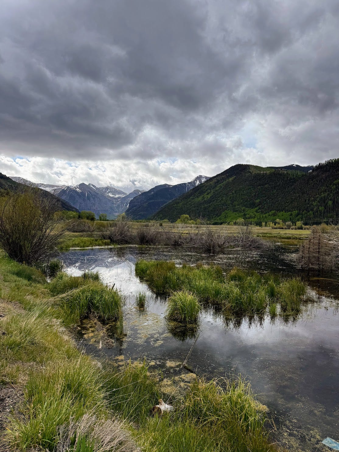
After arriving in Montrose, pick up your rental 4WD car and make your way southeast along Highway 145, winding through the Uncompahgre Plateau and into the San Juan Mountains. Check into your hotel and drop your bags—if you’re staying in Mountain Village head to the free Gondola which you will take down into the town of Telluride—before heading for pre-dinner drinks at The National before dinner. If you’re staying in town, you can walk over, there will be plenty other opportunities to ride the Gondola. This 13-minute ride will offer sweeping views of the Sneffels Range, Mt. Wilson, and Palmyra Peak before dropping you into town. Take advantage of The National’s rooftop bar for pre-dinner drinks before making your way back downstairs for your meal.
Day 1
Agenda
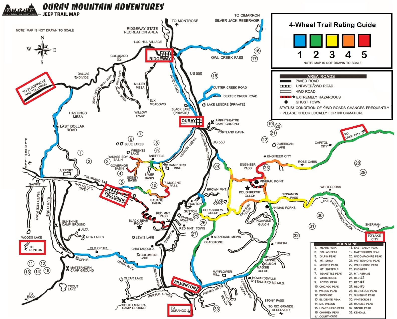
Imogene Pass Jeep Tour
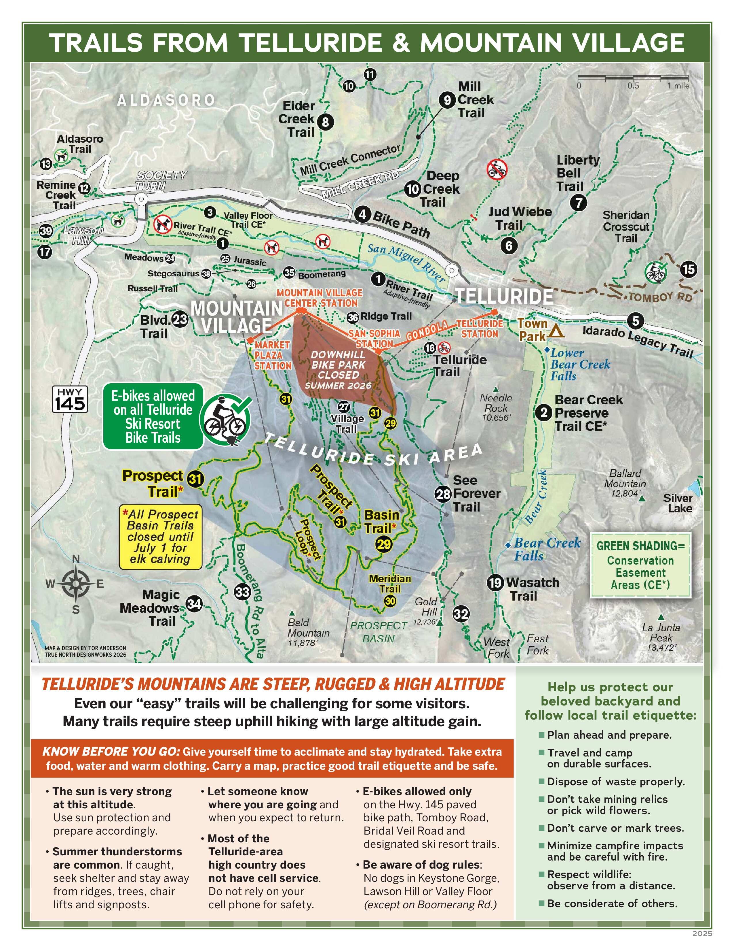
Jud Wiebe Trail - 3 mile loop from town
Morning
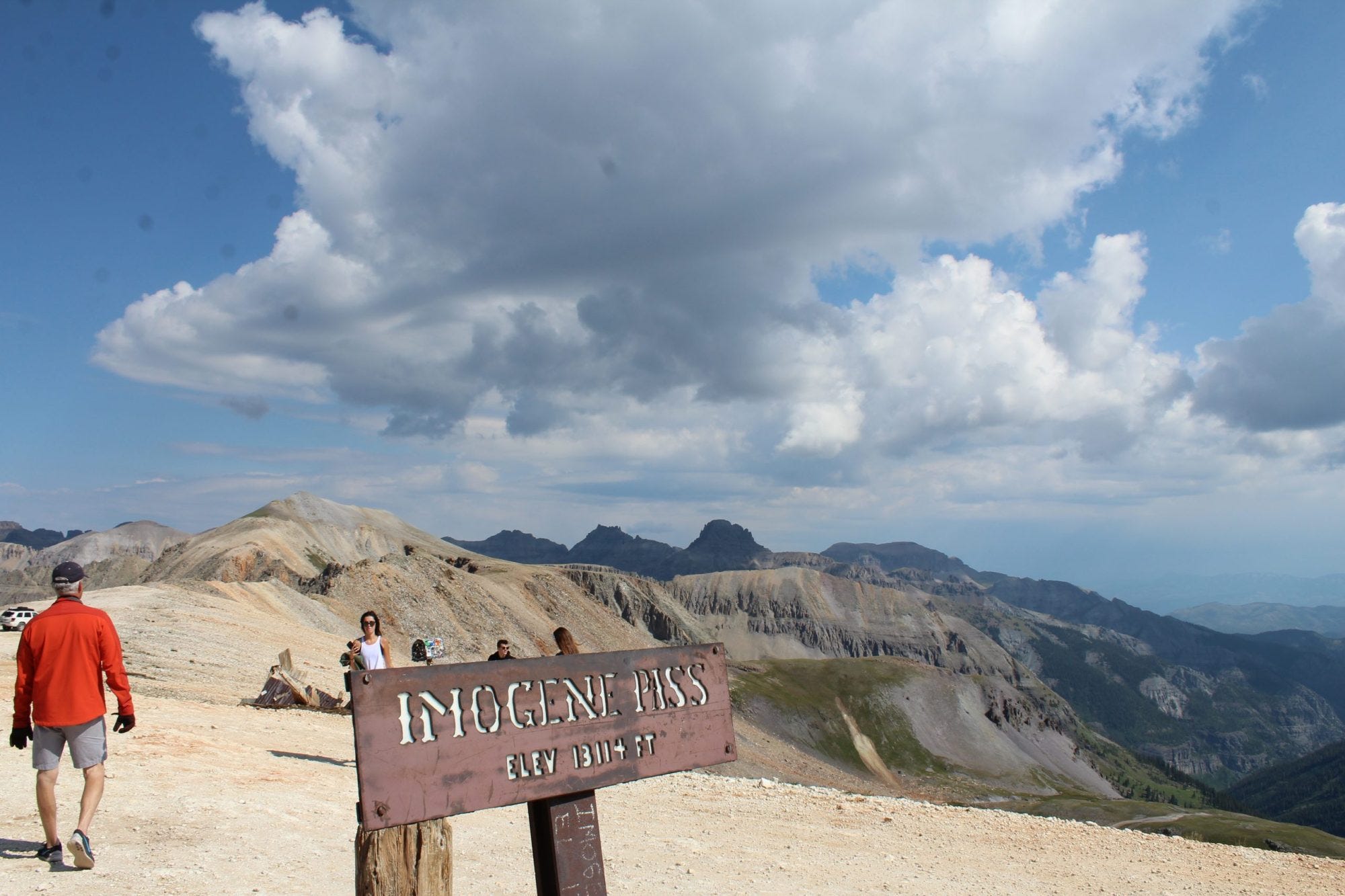
Start the day with breakfast at The Butcher and Baker on E. Colorado Ave. Telluride’s downtown is compact and walkable—Colorado Ave, the main street, is just about half a mile end-to-end. Grab a coffee, some pastries, and their veggie burrito before heading to Telluride Outside—one of the area’s established outfitters—for your 4WD tour over Imogene Pass. The tour is approximately 4 hours, and the pass connects Telluride and Ouray via Tomboy Road, traveling to over 13,000ft, Imogene Pass is one of the highest drivable passes in North America and takes you through dramatic high alpine terrain. The pass has a rich history, serving miners, housing Fort Peabody—a military outpost established in 1904—and hosting an annual foot race. The guided tour will take you past abandoned mines and through sweeping views of the San Juan backcountry.
Afternoon
After returning to town, it’s time for lunch. If you’re looking for a quick bite, head to Baked in Telluride for a sandwich and caffeine, otherwise, head to the bar at Brown Dog Pizza before heading for a short hike of the Jud Wiebe Trail. This is a 3 mile loop that climbs directly from downtown Telluride above the box canyon. The trail offers some of the best panoramic views of the surrounding peaks and valley floor. Depending on your pace, plan for about 1.5-2 hours to complete. If the thrill of Imogene pass tired you out, stroll down Colorado Ave to do some shopping or make your way to the San Miguel River Trail. The trail is sandwiched by the Idarado Legacy Trail to the east and the Valley Floor Trail to the west.


Evening
If you’re feeling up to a pre-dinner drink and manage to get a reservation, take the Gondola back into town and head to Van Atta before making your way to The Grand for dinner. For a more casual evening, we recommend the bar at StrongHouse and ordering their pretzel, chicken sandwich, and local beer.

Day 2
Your biggest hiking day. If you’re staying at a hotel, ask your accommodation to pack you a lunch for the trail, or pick up snacks and sandwiches at The Village Market in Mountain Village or Clark’s Market in town. Choose from one of the three options below based on how much you feel like driving and how your body is feeling — you can't go wrong, all three offer stunning views.
Option 1: Hope Lake Trail
Miles: 6
Type: Out and Back
Elevation Gain: 1,515ft
Difficulty: Moderate
Estimated Time: 3-3.5hrs
Driving Time (from town and Mountain Village): 35min
The trailhead is roughly 35 minutes from Mountain Village and town. Note that the last few miles are on unpaved road and a high clearance 4WD is highly recommended. The trail winds through the Uncompahgre National Forest, crossing several small streams before climbing to Hope Lake at just under 12,000ft. Trailgoers recommend an early start to beat the crowds and catch the best conditions.


Option 2: Blue Lakes Trail (Lower, Middle, and Upper)
Miles: 9
Type: Out and Back
Elevation Gain: 2,513ft
Difficulty: Hard
Estimated Time: 5.5-6hrs
Driving Time: 1hr 14min
Blue Lakes Trail is one of the most popular hikes in Colorado. The trail climbs through subalpine forests and meadows beneath the northeast face of Mt. Sneffels—a 14er—to three turquoise glacial lakes (“Blue Lakes Trail,” n.d.). The trailhead is located southwest of Ridgway via County Road 7, approximately one hour from The Madeline. Plan for 5.5 to 6 hours to complete the trail. Make sure to check The Blue Lakes Visitor Use Management Plan and see what phase they are in and whether a permit is required. We recommend starting early to secure parking and avoid afternoon thunderstorms which are common in the San Juans during the summer months.


Option 3: Bridal Veil Falls to Blue Lake Trail #637
Miles: 8.5
Type: Out and Back
Elevation Gain: 2,763ft
Difficulty: Moderate/Hard
Estimated Time: 5.5-6hrs
Driving Time: 20min
Head east on Colorado Ave through town, continuing on the same road until you reach the Bridal Veil Falls lower parking area. From the trailhead, follow Bridal Veil Trail up through the canyon, passing Bridal Veil Falls—the tallest free-falling waterfall in the state at 365ft. Once you reach the falls, follow the road, past the gate where you’ll intersect with Blue Lake Trail #637. The trail from this point follows an access road and is steep and rugged in places. Along the trail you’ll see evidence of historic mining activity including tram towers and tunnel entrances. Once you reach the lake you’ll be surrounded by La Junta Peak, rising 13,472 feet, and Wasatch Mountain, rising 13,555 feet, visible to the west. Plan for 5.5 to 6 hours on trail.


If you’re looking for a bit of a shorter hike, you can just do the Bridal Veil Falls trail which is just over 2 miles out and back with 850ft of gain.
Evening
After returning from your hike, head back to The Madeline to clean up before heading to your final dinner. Allred’s is perched at 10,500ft at the San Sophia Gondola Station and is one of the most celebrated dining experiences in Telluride. Go a few minutes early and order a cocktail at the bar and enjoy the views looking down into town and the Sneffels range.
Day 3
Before leaving the hotel, make sure you ask for late checkout! Head over to The Coffee Cowboy for coffee and burritos on S. Willow St and E. Pacific. From there, it is another 10-15 minute drive east along Colorado Ave to the Bridal Veil falls lower parking area. Today you’re tackling the Telluride Via Ferrata, located on the south-facing wall below Ajax Peak. The route was conceived by renowned climber and builder Chuck Kroger who identified the ledge systems on the canyon wall. Via Ferrata is Italian for “iron road,” and allows participants to travel through the mountains with the protection of cables and steel and iron rungs.


We strongly encourage booking a local guide. Mountain Trip and San Juan Mountain Guides are trusted local outfitters who offer a range of guided activities throughout the year. Your guide will provide necessary equipment and expertise. Once you’re on the Via Ferrata, there is no escape route.
After completing the route, head back to the hotel to pack up and get ready for your drive back to Montrose for your flight home.